
Comparison of different digital elevation models and satellite imagery for lineament analysis: Implications for identification and spatial arrangement of fault zones in crystalline basement rocks of the southern Black Forest
-
Author:
J. Meixner, J.C. Grimmer, A. Becker, E. Schill, T. Kohl
- Source:
- Date: November 2017
-
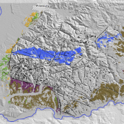
GIS-based remote sensing techniques and lineament mapping provide information on the spatial arrangement of faults and fractures in the southern Black Forest.
links